Geologist Speaks About the Appearance of a Small Island after Maluku Earthquake

Translator

internship

Editor

Petir Garda Bhwana

Rabu, 11 Januari 2023 14:09 WIB

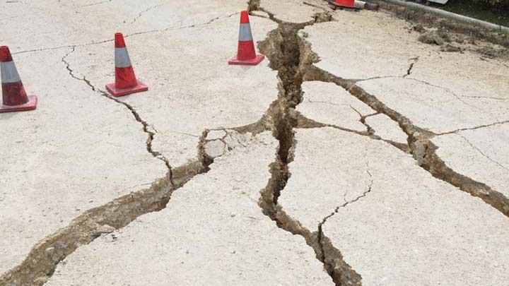
TEMPO.CO, Jakarta - The Head of the Geologist Association of Indonesia (IAGI) Maluku, Herfien Samalehu, stated that the appearance of small island-like material above sea level in Teinaman Village, Tanimbar Islands Regency after the Maluku earthquake, was caused by pressure on the old oceanic plate/slab during subduction that dived into the earth's mantle.

"This can cause the blocks formed at medium depths to move and then result in an earthquake with a magnitude of 7.5 with a depth of 130 km," Herfien said Tuesday, January 10, 2023.

According to Herfien, the earthquake that occurred in the Tanimbar Islands Regency was a thrust type of earthquake, referred to as an upward fault from the subduction of the Banda Sea. This can be seen from the analysis of the location of the hypocenter and its depth.

The type of earthquake causes an increase or uplift as well as a decrease or subsidence on the sides. For example, several earthquake events such as the earthquake in Aceh and Nias where there was an uplift around Simeulue Island, but there were also blocks that dropped or subsided up to 1 meter along the coastline in Aceh. In addition, the earthquake in Lombok resulted in the phenomenon of the rising of the island by 25 cm which is seen from the indications of the satellite map which shows an increase from the surface. This phenomenon can occur after an earthquake which causes regional deformation.

"In this case, the rise in land in Teneman, Southwest Maluku district, is a block that has risen as a whole, in this case, it has no significant effect on the Tanimbar region," he said.

The impact of this earthquake did not cause collateral hazards in the form of massive-scale avalanches, ground motion accompanied by liquefaction and tsunamis. "We urge the public to remain calm and follow directions from the local BPBD or BMKG. Do not be provoked by untrustworthy issues regarding the earthquake and tsunami," he said.

In the Banda Sea and the area around the Tanimbar Islands, Southwest Maluku Regency is classified as prone to earthquakes and tsunamis. According to the records of the Geological Agency, tsunamis hit the area around the Banda Sea in 1629, 1852, 1938 and 1975.

KHAIRIYAH FITRI | IMAJI LASAHIDO (INTERN)

Click here to get the latest news updates from Tempo on Google News

Related News

Earthquake Shakes Garut 4 Times, BMKG Data Shows

2 hari lalu

Earthquake Shakes Garut 4 Times, BMKG Data Shows

Another earthquake shook Garut and some parts of West Java on Wednesday night, May 1.

Read More

West Java's Bandung Jolted by 4.2M Earthquake, 2 Aftershocks: BMKG

3 hari lalu

West Java's Bandung Jolted by 4.2M Earthquake, 2 Aftershocks: BMKG

An earthquake measuring 4.2 magnitudes jolted Bandung Regency, West Java, at 10:06 a.m. local time on Wednesday, May 1, as reported by the BMKG.

Read More

M 5.5 Earthquake Hits Indonesia's North Maluku Province

3 hari lalu

M 5.5 Earthquake Hits Indonesia's North Maluku Province

An earthquake shook the Jailolo area, West Halmahera Regency, North Maluku on Tuesday, April 30 at 20:52 West Indonesia Time.

Read More

Estimated Loss from Garut Earthquake Hits Rp12.6bn

4 hari lalu

Estimated Loss from Garut Earthquake Hits Rp12.6bn

The Garut Disaster Mitigation Agency (BPBD) states that the total losses from the 6.2 magnitude earthquake reached Rp12.6 billion.

Read More

West Java Prone to Earthquakes; BMKG Asks Public to Adapt, Proactive in Disaster Mitigation

4 hari lalu

West Java Prone to Earthquakes; BMKG Asks Public to Adapt, Proactive in Disaster Mitigation

BMKG highlighted the region's history of frequent earthquakes dating back to 1844 in areas like Garut, Cianjur, Tasikmalaya, Pangandaran, and Sukabumi

Read More

BNPB: Houses Damaged by Garut Earthquake Raise to 267

5 hari lalu

BNPB: Houses Damaged by Garut Earthquake Raise to 267

The BPBD is still updating data on settlements affected by the 6.2-magnitude Garut earthquake that struck at 23:29 WIB Saturday night, April 27.

Read More

Indonesia's 6.5-magnitude Garut Earthquake Damages 41 Houses, BPBD Says

6 hari lalu

Indonesia's 6.5-magnitude Garut Earthquake Damages 41 Houses, BPBD Says

The 6.5-magnitude earthquake that jolted Garut, Indonesia has resulted in at least 41 damaged houses, according to the BPBD.

Read More

BPBD Garut Monitors Entire Area After Earthquake Occurs

6 hari lalu

BPBD Garut Monitors Entire Area After Earthquake Occurs

Regional Disaster Management Agency (BPBD) of Garut is monitoring the entire area to determine the impact following an earthquake.

Read More

11 Trains Temporarily Halted during Garut Earthquake in West Java, Indonesia

6 hari lalu

11 Trains Temporarily Halted during Garut Earthquake in West Java, Indonesia

PT Kereta Api Indonesia (KAI) said that 11 trains were urged to halt temporarily during the Garut earthquake in West Java, Indonesia, on Saturday.

Read More

6.5 Magnitude Earthquake Jolts Indonesia's West Java, Shocks Felt in Depok

6 hari lalu

6.5 Magnitude Earthquake Jolts Indonesia's West Java, Shocks Felt in Depok

An earthquake with a magnitude of 6.5 struck off the coast of Indonesia's Java island on Saturday night.

Read More