BMKG Warns of High Waves in Indonesian Waters
Translator
Editor
27 July 2023 12:17 WIB
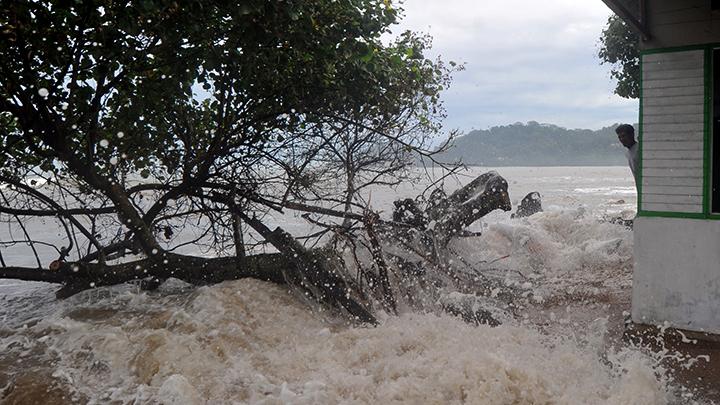
TEMPO.CO, Jakarta - The Meteorology, Climatology, and Geophysics Agency (BMKG) warned coastal communities to remain vigilant of 6-meter-high waves in Indonesian waters on July 27-28, 2023. "Please be warned for people living and doing activities around the coastal areas with the potential for high waves to remain vigilant," said the Head of Maritime Meteorology Center of BMKG, Eko Prasetyo in Jakarta, on Thursday, July 27, 2023.
He said the wind pattern is one of the causes of high waves. "The wind pattern in the north of Indonesia moves from the south-southwest with wind velocity around 6-25 knot, and in the south of Indonesia the wind dominantly moves from the east-northeast with wind velocity around 6-27 knot," he explained.
The highest wind velocity is recorded in the west and south of the Sunda Strait, south of Banten Waters, north of Lombok Strait, Bali Sea, Sumbawa Sea, south of Makassar Strait, Maluku Sea, Halmahera Sea, south of Merauke Waters, and Arafuru Sea.
The condition will cause a potential risk of 1.25-2.5 meters high waves in the north of Malaka Strait, Sabang-Banda Aceh Waters, Ombai Strait, North Natuna Sea, Anambas-Natuna Islands Waters, Subi-Serasan Islands Waters, Natuna Sea, Karimata Strait, Java Sea, Kota Baru Waters, Makassar Strait, Bali Sea, Sumbawa Sea, Flores Sea, north of Lombok Strait, North Kalimantan Waters, west of Sulawesi Sea, Bitung-Likupang Waters, south of North Sulawesi Waters, and Maluku Sea.
Further, at risk are Banggai-Sula Waters, Tolo Strait, Manui Kendari Waters, Wakatobi Waters, Seram Sea, Halmahera Waters, Halmahera Sea, Obi Waters, Misool Waters, Buru-Seram Islands Waters, Sorong Waters, Fak-Fak-Kaimana Waters, north of Raja Ampat Waters, Jayapura-Sarmi Waters, Banda Sea, Kai-Aru Islands Waters, Sermata-Tanimbar Islands Waters, Arafuru Sea, Pacific Ocean north of Halmahera-West Papua Waters, and Pacific Ocean north of Papua.
6 Meters High Waves in the south of West Java, Yogyakarta, and East Java
Higher waves, at 2.5-4 meters will potentially happen north of Sabang Waters, north of Alas-Sape Waters, north of Aceh, Nias Islands Waters, Bengkulu Waters, Lampung Strait, Indian Ocean west of Aceh, south of Bali Strait-Lombok-Alas-Sape, west of Sumba Strait, Sawu Island Waters, Sawu Sea, Kupang-Rote Island Waters, Indian Ocean south of Kupang, Sitaro Islands Waters, Sangihe-Talaud Islands Waters, and north of Maluku Sea.
Meanwhile, very high waves at 4-6 meters potentially happen at west of Mentawai Islands Waters, Enggano Island Waters, west of Lampung Waters, Indian Ocean west of Nias Islands to Lampung, west and south of Sunda Strait, south of Banten-West Java Waters, south of Central Java-Yogyakarta-East Java Waters, south of Bali-West Nusa Tenggara-Sumba Island Waters, and Indian Ocean south of Banten-Sumba Island.
ANTARA
Editor's Choice: Papua's Tembagapura Sees Rare Snowfall; BMKG Explains
Click here to get the latest news updates from Tempo on Google News