BMKG Talks of Potential Strong Winds in Jakarta
Translator
Editor
24 November 2021 15:58 WIB

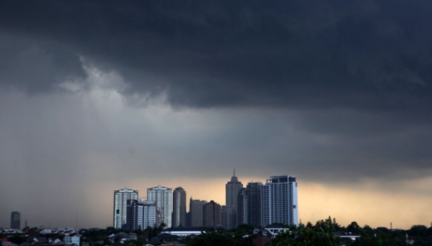
TEMPO.CO, Jakarta - The Meteorology, Climatology, and Geophysics Agency or BMKG recorded strong winds on Tuesday evening at 18:30-19:00 Jakarta times, ranging from 28-46 kilometers per hour, in several Jakarta areas, including Cengkareng, Kemayoran, Halim, and Tanjung Priok.
According to the agency, the weather phenomenon was as announced in the weather forecast issued on November 23 at 07:00 local time. “And updated at 17:00 local time,” as read in the written statement made by the agency’s Deputy for Meteorology Guswanto on Wednesday, November 24.
Based on the analysis results of the atmospheric dynamics, the strong wind was created by a fairly strong air mass flow from the Indian Ocean, in the west of Banten. The air mass was blowing eastward to around the northern areas of Tangerang and Jakarta.
The strong flow was indirectly triggered by a significant difference in air pressure as the impact of the presence of low pressure, including Tropical Cyclone Paddy, around the Indian Ocean, in the south of Java.
BMKG also predicted that the speed of the winds will decrease in the next 24 hours along with the weakening of Tropical Cyclone Paddy. However, people are appealed to stay vigilant over potential extreme weather, such as heavy rain and strong wind, that may cause hydrometeorological disasters of flooding, flash floods, and landslides.
Read: BMKG Warns of Heavy Rains, Tidal Floods in Several Indonesian Regions
ANWAR SISWADI (CONTRIBUTOR)