BMKG: Beware of Heavy Rain, High Wave due to Riley Tropical Storm
Translator
Editor
24 January 2019 16:29 WIB

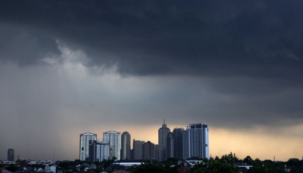
TEMPO.CO, Bandung - The Meteorology, Climatology, and Geophysics Agency (BMKG) detected Riley Tropical storm in the southern waters of Timor Sea, Thursday, January 24. The natural event is predicted to affect several regions, such as by the occurrence of medium to heavy rains in Java Island and high waves, even though it is moving away from Indonesia.
BMKG head of weather forecast, Agie Wandala Putra, explained that based on the agency's review today at 07:00 a.m, the cyclone is located in the southern waters of Timor Sea, precisely at 16.9 south latitude and 120.8 east longitude. “Or around 810 kilometers south of Waingapu,” Agie added.
The cyclone moves to the west and southwest at a speed of 11 knots or 20 kilometers per hour. On Friday, January 25, the position is predicted to be at the southern of Timor Sea at 890 kilometers away south-southwest of Waingapu. “Its strength likely reaches 60 knots or 110 kilometers per hour,” Agie explained.
Due to Riley tropical storm, BMKG announced, medium to heavy rains possibly hit West Java, Central Java, Yogyakarta, East Java, Bali, West Nusa Tenggara, and East Nusa Tenggara.
Around 4-7 meters high of waves also potentially occur in the southern waters of East Java until Sumba Island, Bali Strait, Lombok Strait, southern of Alas Strait, and western area of Sumba Strait.
Furthermore, high waves with the height of 2.5 to 4 meters potentially strike southern waters of Central Java, Sumba Strait, South Indian Ocean, West Java, up to Central Java, Sumba Strait, and Ombai Strait.
ANWAR SISWADI (CONTRIBUTOR)