

M 5.5 Earthquake Hits Indonesia's North Maluku Province
Translator
Editor
1 May 2024 11:13 WIB
TEMPO.CO, Jakarta - An earthquake shook the Jailolo area, West Halmahera Regency, North Maluku on Tuesday, April 30 at 20:52 West Indonesia Time. According to the Meteorology, Climatology and Geophysics Agency (BMKG), it was a tectonic earthquake with a magnitude of 5.5.
"The center of the earthquake was located at coordinates 2.39° N, 126.79° E, or more precisely in the sea, 110 kilometers northwest of Doi Island, North Maluku, at a depth of 72 kilometers," BMKG earthquake and tsunami center head Daryono said in a written statement Tuesday night.
Daryono said that based on the location of the epicenter and the depth of the hypocenter, the tectonic earthquake was a type of moderate earthquake due to rock deformation on the Maluku Sea Plate. "The results of the source mechanism analysis show that the earthquake had a thrust fault mechanism," he said.
Based on shakemap estimates, the earthquake sent tremors to the areas of Loloda, West Halmahera, Batang Dua Island and Ternate City, North Maluku, with an intensity scale of III MMI.
So far, Daryono said, there have been no reports on the impact of the damage caused by the earthquake. "Modeling results show that this earthquake does not have the potential to generate a tsunami," he said.
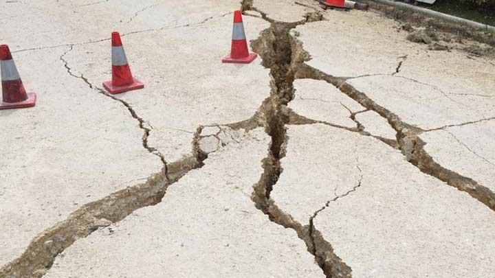
As of 21:15 WIB, BMKG monitoring results had not shown any aftershocks. Residents are advised to avoid buildings that have been cracked or damaged by the earthquake.
"Before returning to your homes, check and make sure that the structure of your residence is strong enough to withstand earthquakes and that there is no damage due to earthquake vibrations that threaten the stability of the building," he said.
TEMPO.CO
Editor's Choice: Estimated Loss from Garut Earthquake Hits Rp12.6bn
Click here to get the latest news updates from Tempo on Google News


