BMKG Warns of Extreme Weather Potential During Rice Harvest Period
Translator
Editor
27 February 2024 15:23 WIB

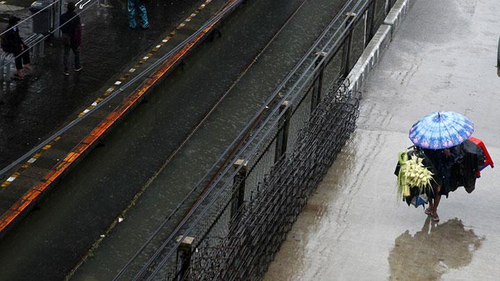
TEMPO.CO, Jakarta - The harvest in several rice centers is overshadowed by extreme weather during the transition period from rainy to dry season.
The Ministry of Agriculture said that the harvest in several areas begins in March and April 2024. Director of Cereals, Directorate General of Food Crops at the Ministry of Agriculture, Ismail Wahab, said that Ngawi is one of the harvest-ready areas.
He also estimated that rice production in April will be higher than in March. In East Java, for example, it is predicted that there will be 239,000 hectares of rice harvest in March 2024 compared to the 300,000 hectares of rice harvest in April.
Furthermore, he ensured no more rice shortage once the harvest period started. In January 2024, it is estimated that rice production will reach 1.6 million tons of milled dry grain. Then, in February 2024, rice production was around 2.4 million tons of milled dry grain. Meanwhile, in March 2024, rice production is predicted to reach 6.1 million tons of milled dry grain.
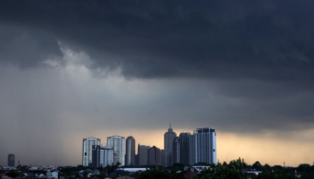
The Meteorology, Climatology, and Geophysics Agency (BMKG) reminds the public to be aware of the extreme weather potential during the transition period.
"Beware of extreme weather such as heavy rain in a short duration with lightning and strong winds, as well as hail," said the Head of BMKG, Dwikorita Karnawati on Sunday, Feb 25.
She said that based on the analysis of atmospheric dynamics carried out by BMKG, the peak of the rainy season has passed in various regions of Indonesia, especially the southern parts.
Dwikorita explained that one of the characteristics of the transition period is afternoon until late evening rains, preceded by warm and hot air in the morning until midday. Rain during this period, she went on, tends to be uneven with medium to heavy intensity in a short duration. If atmospheric conditions become unstable, the potential for the formation of convective clouds such as Cumulonimbus (CB) will increase.
"The shape is like a cauliflower, the color is grayish with clear edges," she said, describing the clouds.
"Heavy rainfall is one of the triggers for hydrometeorological disasters, such as flash floods and landslides. We also urge people who live in landslide-prone areas to be alert and careful," she added.
IRSYAN HASYIM
Editor's Choice: BMKG Warns of Tidal Flood as Ex-Tropical Cyclone Lincoln Triggers Heavy Rain, Strong Winds
Click here to get the latest news updates from Tempo on Google News