Bali Governor Calls for Calm despite Eruption of Mount Agung
27 November 2017 13:44 WIB

TEMPO.CO, Denpasar - Bali Governor Made Mangku Pastika has urged the public to stay calm and follow procedures outlined by the Bali disaster mitigation office in the wake of magmatic eruptions of Mount Agung in Karangasem District.
"I hope all residents of Bali, particularly Karangasem, would remain calm and vigilant, as Mount Agung erupts," the governor stated on Sunday evening.
He also urged people living in the danger zone to follow the government`s instructions, particularly those concerning evacuation.
Read also: Mount Agung Alert Status Raised as Volcanic Activity Increases
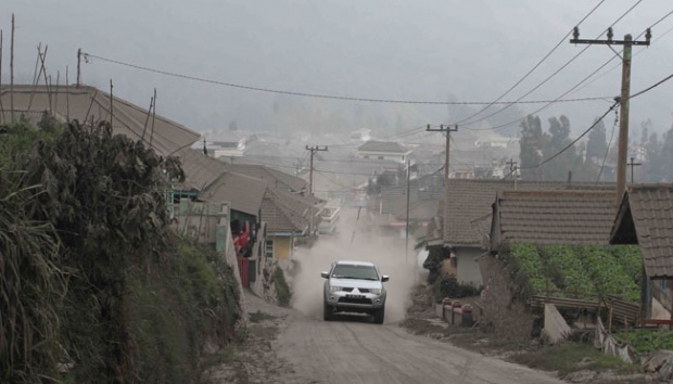
To prevent casualties, residents of villages located in the danger zone should stay at the evacuation locations, he noted.
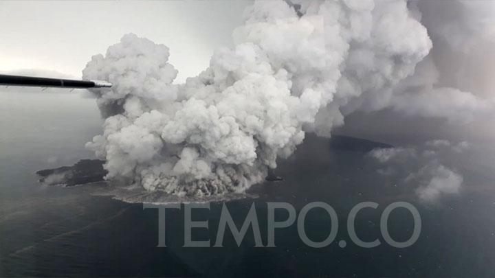
The Indonesian Volcanology and Geological Disaster Mitigation Center (PVMBG) has raised the alert status of Mount Agung from level three to level four, indicating eruption hazards on and near the volcano.
"We raise the status, as the eruptions of Mount Agung have shifted from phreatic to magmatic ones, since a red glow was visible from the peak of Mount Agung on Sunday at 9 p.m. local time," I Gede Suantika, the mitigation head of PVMBG, said on Monday.
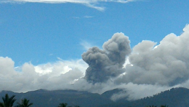
The magmatic eruptions produced thick ash being spewed continually to heights of between two thousand and 3,400 meters from the volcano`s peak.
Suantika has forecast larger explosions as is indicated by the continuous ash puffs that are sometimes accompanied by explosive eruptions along with a weak sound of boom audible at the radius of up to 12 kilometers from the mountain`s top.
The danger zone has been expanded from six kilometers to eight kilometers from the volcano`s peak.
Read also: Mount Agung: Warning Flight Status Raised to the Highest `Red`
People living within 10 kilometers towards the north, north east, southeast, south, and southwest has been advised to evacuate.
Villages located in the danger zone are Ban, Dukuh, Baturinggit, Sukadana, Kubu, Tulamben, Datah, Nawakerti, Pitpit, Bhuana Giri, Bebandem, Jungutan, North Duda, Amerta Bhuana, Sebudi, Besakih, and Pempatan.
The danger zone can change any time based on the condition of the volcano.
Meanwhile, the Bali airport authorities have shut down the I Gusti Ngurah Rai International Airport for 24 hours following the eruptions of Mount Agung.
"The airport is closed since 7 a.m. Central Indonesian Standard Time (WITA)," Arie Ahsanurrohim, spokesman of state-owned airport operator PT Angkasa Pura I`s I Gusti Ngurah Rai International Airport, said.
Volcanic ash dispersed into the air over the airport after the second eruption, forced the closure of the airport for 24 hours from 7 a.m. local time on Monday.
The Indonesian Transportation Ministry has issued a notice to airman no. A-4242/17 on the closure.
Based on data issued by PT Angkara Pusa I, a total of 57 international flights and 39 domestic flights were canceled from Saturday until Sunday at 11:59 p.m. local time.
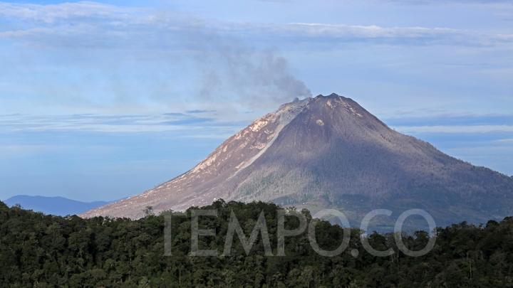
Located in Karangasem, Bali Island, the 3,142-meter-high Mount Agung has been rumbling since August.
Records since 1800 reveal that Mount Agung had experienced four mega eruptions, respectively in 1908, 1823, 1843, and 1963.
ANTARA