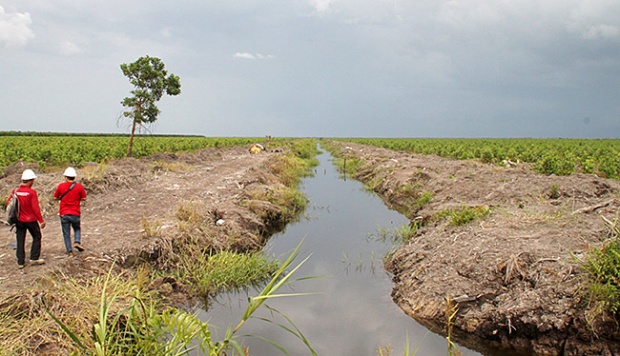
TEMPO.CO, Jakarta - There it was, in the interior of Papua's Merauke regency - a big blue rectangle in a sea of green. Clara Rondonuwu zoomed in her laptop screen; the shape, peppered with pink dots, came into sharper focus. Clicking her mouse, she drew a polygon around it, conjuring statistics for tree cover loss and gain in a certain time period.
In another tab, Clara had open a photo of an oil palm plantation in the Papuan jungle. It had been posted to Flickr by someone called Michael Thirnbeck. "We can contact this guy, ask him where it is," she said. "Because it looks like the place in the map."
Displayed on Clara's computer was Global Forest Watch (GFW), a new online tool for monitoring forests that is already changing the way journalists report about them. On Friday night last week, when Clara gave her colleagues from the Society of Indonesian Environmental Journalists a brief introduction to its use-she had participated in a training of trainers the previous week they tossed around a variety of story ideas they might use the platform to explore: Had Java's land area dedicated to rice farming decreased? What about a particular group of indigenous people in Riau, whose territory had been hemmed in by logging?
The project, spearheaded by the World Resources Institute (WRI) and launched in February, has seen a handful of early adopters. The daily Kompas used its hotspot data as the basis of a piece on Riau's haze crisis. Greenpeace took advantage for a report on deforestation in Sumatra.
No outlet has been more prolific than Mongabay, which has put out at least seven stories bolstered by GFW maps and data. Rhett Butler, founder of the environmental news site, said the tool had become indispensable. "I use Global Forest Watch almost every time I do a forest story now," he told Tempo.
So far, Mongabay has mostly employed it to supplement articles it would have done anyway. But perhaps more exciting are GFW's prospects for story discovery. "I think it's a fountain of potential stories," Butler said. "Once you understand how the tool works, an easy place to go and find something to pitch to your editor."
GFW's scope is unprecedented: never before has this granular of data about where deforestation is happening, updated this frequently, been available for the entire world. The system draws on two core data sets, each of which derives from a separate set of satellites orbiting the Earth. One was made possible by an algorithm University of Maryland researchers designed to analyze Landsat data. The other comes from the FORMA system, debuted along with GFW and which processes National Aeronautics and Space Administration (NASA) imagery; it works faster but at a lower resolution than the Maryland side.
Google's cloud computing power was key, said Crystal Davis, GFW's senior manager. The Maryland data, for example, deals in petabytes; a laptop would need about 100 years to get through it. "What Google was able to do was farm out the data to thousands of computers in their cloud, and then pull it back together within about a week," Davis told Tempo. "Now that's why you can do it across the entire globe, whereas before you just had this piecemeal analysis of certain places, usually by some individual person looking at imagery on their computer."
GFW's other innovation: the platform itself. Never before has WRI developed a mapping information tool that could speak so well to the average person. One need not be a geographic information system (GIS) or remote sensing specialist to make sense of it. "Middle schoolers will understand what this is telling you," Davis said. "This is our most concerted effort to reach journalists and the broader public."
Mongabay is at the forefront of that. On Friday last week, it announced the Global Forest Reporting Network (GFRN), which aims to enlist some two dozen journalists from around the world to produce stories with GFW. Butler wants them to collectively put out at least 180 pieces by the end of next March. They'll cover topics like deforestation, forest recovery, agricultural expansion into forest areas and illegal logging.
WRI is partnering with Mongabay to develop training videos, though the platform is simple enough that instruction should not preclude getting started. The videos will focus more on examples of previous stories. One recent Mongabay piece, for instance, looked at 500,000 hectares of forest loss in an area of China near Russia over the past 10 years. "The narrative around China is that the government has cracked down on deforestation so it's all reforestation now," Butler said. "But Global Forest Watch clearly shows there is still a lot of natural forest being chopped down, which is a story I don't think many people are aware of."
Something yet to be written might look at West Kalimantan, where oil palm plantations have appeared inside protected areas. Another could examine deforestation in the Ivory Coast's Marahoué National Park, which according to a recent study lost 93 percent of its forest cover between 2002 and 2008. "Looking at the data, they can see that the issue is there," Butler said. "That could lead to stories where they would interview officials or conservationists and try to figure out why that park is disappearing so quickly."
Among the platform's features are subscribable, near-real-time alerts for whenever something pops up in a specific area. This is enabled by the FORMA system, updated every 16 days. GFW also includes crowd-sourcing tools, allowing anyone to upload stories or photos in connection with a location. Snapshots of the interface provide useful graphics.
Users can also overlay concession maps for logging, mining, palm oil and wood fiber plantations-at least as far as the data exists in the public domain. Davis and her team are undertaking a sort of scavenger hunt to bring in as much data as possible from governments and other sources to compliment what they developed themselves. Some were more willing and able to share than others. Indonesia is actually one of only several countries to have disclosed concession data, though it has done so only for certain industries and as far as 2010.
"Of course the caveat is that Indonesia's data still has a lot of issues," Butler said. "Overlapping concessions, concessions that aren't registered, things like that. That's really a limitation, but it's far and away better than a place like Malaysia, or other parts of the world in terms of having the concession data."
One of the best upgrades to the system would be the capacity to distinguish plantations from natural forest, he added. Clara had the same thought as she scrutinized that blue and pink rectangle in Merauke. Was she looking at an oil palm plantation? Overlaying the relevant forest use mask showed a concession roughly on the spot, but its boundaries did not quite match the colors on her screen. She was not sure what to make of it. "The accuracy of this map depends on which area you look," she said. "That's why you need to layer it with stories."
That will not stop her from using it. "With this technology," she said, "you're able to tell stories in different ways."
PHILIP JACOBSON