

Hail, Thunderstorm, and Floods Hit Bandar Lampung
Translator
Editor
20 September 2022 06:39 WIB
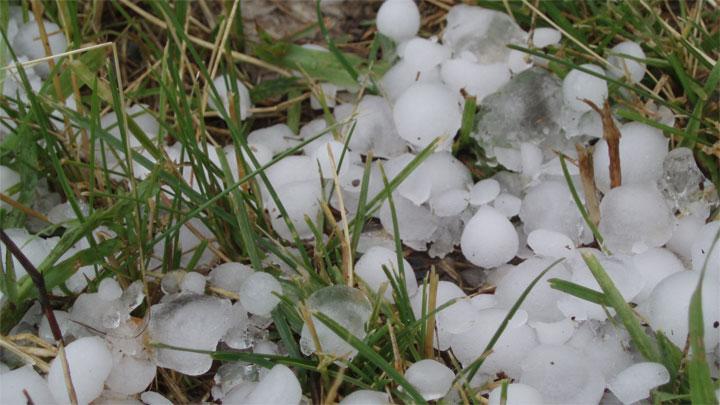
TEMPO.CO, Jakarta - Videos showing hail in Bandar Lampung on Monday, September 19, 2022, were widely circulated on social media. Floods and strong winds also hit the region.
Adi Saputra, a forecaster from the Meteorology, Climatology, and Geophysics Agency or BMKG Lampung, confirmed that the incidents occurred between 11:40-18:00 western Indonesian time (WIB).
“Cumulonimbus clouds cause heavy rain, hail, and strong winds that lead to floods and fallen trees,” Adi said on Monday, adding that the rainfall intensity was recorded at above 100 millimeters.
The agency issued an early warning for thunderstorms in the region on September 19, 2022, at 10:30 WIB. The same warning was released at 17:30 WIB.
The head of the Radin Inten II Lampung Meteorological Station, Kukuh Ribudiyanto, recommended the public and related agencies remain vigilant against the potential for tornadoes in the afternoon and evening.
This is marked by strong heating between 10:00 to 14:00 WIB, resulting in the formation of convective clouds with a dark cloud base.
Kukuh also noted that people residing in mountainous or cliff areas and areas prone to landslides must stay alert to light to moderate-intensity rain that possibly occurs for several consecutive days.
According to him, extreme weather might hit Indonesian regions until the end of September because the transition phase into the rainy season is still ongoing.
MARIA FRANSISCA LAHUR
Click here to get the latest news updates from Tempo on Google News


