Tropical Storm Choi-Wan Brings Thunderstorm Threat to Jakarta: BMKG
Translator
Editor
2 June 2021 07:32 WIB

TEMPO.CO, Jakarta - Tropical storm Choi-Wan was observed in the eastern waters of the Philippines and likely to move to the northwest today, June 2. This means the storm was moving further away from the north of West Papua. However, Indonesia’s Meteorology, Climatology, and Geophysics Agency (BMKG) issued a warning of its indirect impact on the country's territory.
The BMKG mentioned impacts of the meeting area and the deceleration of wind speed (convergence) that extends from East Kalimantan to North Kalimantan on June 1-3, 2021, and the formation of confluence areas in the northern Sulu Sea to the eastern waters of the Philippines.
“This condition is able to increase the potential for growth of rain clouds around the tropical cyclone area and along the convergence and confluence areas,” said the agency via its Instagram account on Tuesday, June 1.
The agency reiterated that the surge in surface wind speed, which was induced by the tropical storm in the Sulu Sea and the eastern Pacific Ocean of the Philippines, was able to increase the wave height in these waters. The convergence area was observed extending from the western waters of West Sumatra to Riau, on the west coast of Banten to the western waters of Bengkulu, in Central Kalimantan to North Kalimantan, in Southeast Sulawesi to Central Sulawesi, and extending in central Papua.
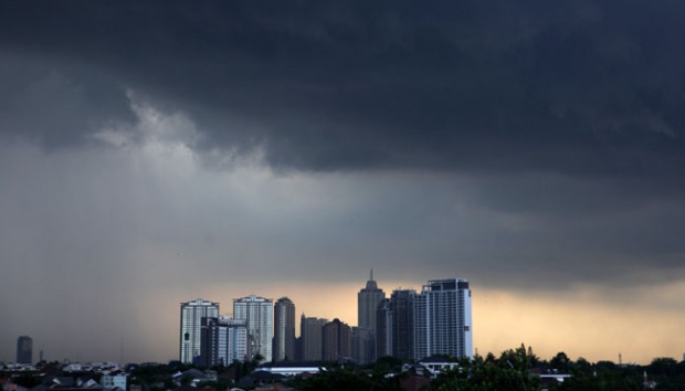
“This can bring the potential for thunderstorms and strong winds in the Jakarta area and its surroundings on June 1-3, 2021,” the agency announced, appealing to the public to stay vigilant and careful of the potential for extreme weather.
Read: BMKG: Beware of Heavy Rain, High Wave due to Riley Tropical Storm
ZACHARIAS WURAGIL